
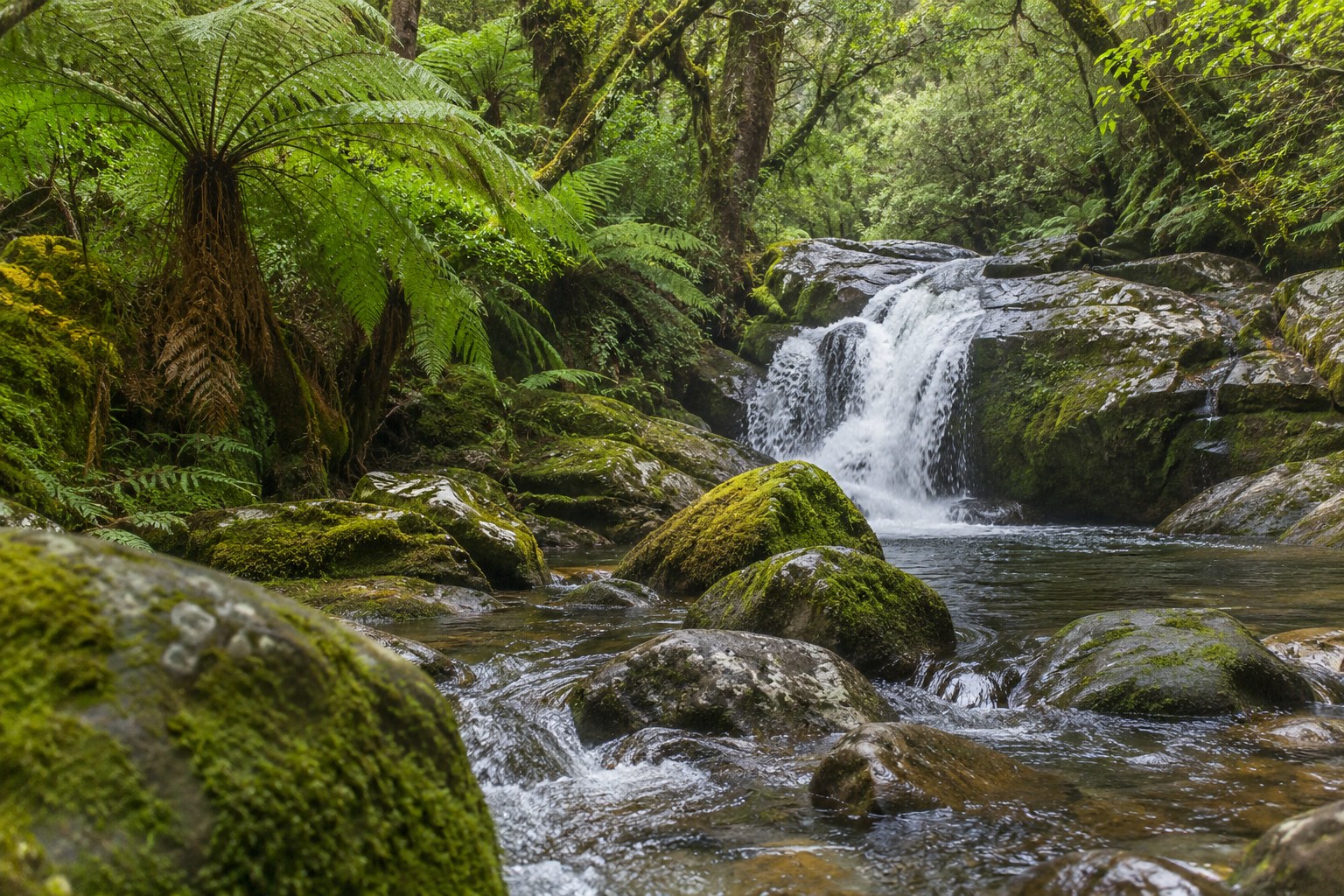
A coastal walk, a mountain tramp and a lake paddle can sit within a few hours of each other in Aotearoa New Zealand. They demand different plans. On the Abel Tasman Coast Track, a tide can determine when a section is passable. On the Tongariro Alpine Crossing, wind, snow and volcanic conditions matter more than the distance on a map. A family cycle ride in Central Otago calls for a different level of preparation from a remote West Coast mountain-bike trail.
New Zealand's nature and recreation options stretch from kauri forests and geothermal valleys to alpine national parks, surf beaches, marine reserves and dark-sky sanctuaries. The most rewarding choice is the one that fits the landscape, season, available time and abilities of everyone travelling. A short bush walk with native birds can be a better day outdoors than a famous summit attempted in unsuitable weather.
Choose by experience before choosing a destination
The first filter is what you want to do: walk, ride, paddle, observe wildlife or spend time in a landscape without a demanding physical challenge. The second is how much exposure to weather, water and remote terrain you are prepared to manage.
| Outdoor experience | Good New Zealand options | Best suited to | What changes the plan |
|---|---|---|---|
| Easy nature walks | Rotorua's Redwoods, Wellington reserves, Milford Foreshore, Bennetts Bluff | Families, mixed-ability groups, short breaks | Track grade, transport and accessibility |
| Alpine day walks | Tongariro, Hooker Valley, Arthur's Pass, Wānaka | Fit walkers seeking mountain scenery | Snow, exposure, weather and daylight |
| Coastal exploration | Abel Tasman, Coromandel, Bay of Islands, Marlborough Sounds | Walking, swimming, sailing and kayaking | Tides, swell, wind and water transport |
| Cycling and mountain biking | Ngā Haerenga Great Rides, Rotorua, Queenstown, Otago | Leisure riders through to technical bikers | Trail grade, surface, distance and return shuttle |
| Wildlife encounters | Kaikōura, Tiritiri Matangi, Ōtago Peninsula, Rakiura | Birdwatchers and marine-life enthusiasts | Season, ethical viewing distance and access |
| Adventure sports | Queenstown, Taupō, Rotorua, Waitomo | People seeking guided, equipment-based activities | Operator requirements, water levels and weather |
| Snow sports and night skies | Ruapehu, Canterbury and Otago ski fields; Aoraki Mackenzie | Winter travellers and stargazers | Snow cover, road conditions, cloud and moonlight |
North Island nature: volcanoes, forests, islands and rivers
Northland and Auckland: native forest and coastal wildlife
Northland combines the ancient kauri forests of Waipoua with the sheltered bays and boating of the Bay of Islands. Walkways through kauri country need particular care: soil moved on boots or equipment can spread the pathogen responsible for kauri dieback. Footwear cleaning stations, marked routes and temporary closures protect trees whose root systems extend well beyond their trunks.
The Poor Knights Islands Marine Reserve, reached by boat from the Tūtūkākā coast, is a distinct choice for snorkelling and scuba diving. Underwater arches, kelp forests, reef fish and marine life are protected within the reserve; collecting seafood or fishing there is prohibited. Sea conditions, not just visibility, determine whether a dive or snorkel trip is suitable.
Auckland provides accessible nature without a long road trip. Rangitoto Island offers a volcanic summit walk across lava fields, while Tiritiri Matangi is a restored open wildlife sanctuary in the Hauraki Gulf. Its forest and coastal tracks support species such as takahē, kōkako, hihi and tīeke, alongside native reptiles such as tuatara. Island visits require clean, pest-free gear, and ferry schedules set the shape of the day. Aotea/Great Barrier Island adds forest walks, beaches and dark skies for a longer island escape.
West-coast beaches such as Piha and the surf breaks around Raglan suit confident surfers who understand local conditions. Sheltered-looking water is not proof of safe swimming: rip currents and changing surf make patrolled beaches and the red-and-yellow flags the sounder option for swimmers.
Rotorua, Taupō and Tongariro: geothermal landscapes and active recreation
Rotorua pairs geothermal features with mountain biking, lakes and Māori cultural experiences. At Whakarewarewa and Te Puia, geysers and steaming ground sit within a living cultural landscape; Waimangu Volcanic Valley and Wai-O-Tapu reveal different geothermal formations, including colourful mineral pools and thermal terraces. These are managed sites with marked walking routes. Hot ground and water are not places to improvise an off-track shortcut.
In the Whakarewarewa Forest, known for its redwoods, mountain-bike trails range from gentler rides to demanding technical lines. The Whakarewarewa Forest Loop is also part of the Ngā Haerenga Great Rides network. Nearby Lake Rotorua, Lake Tikitapu and Lake Tarawera offer different options for lakeside walks, paddling and organised water activities.
Taupō sits beside New Zealand's largest lake, with Huka Falls, the Waikato River and routes towards Tongariro National Park. The Tongariro Alpine Crossing is a 20.2 km one-way journey through volcanic terrain, passing features such as Red Crater and the Emerald Lakes. DOC lists around seven to eight hours in the usual summer walking season. It is a strenuous day requiring a shuttle or other end-to-end transport, suitable clothing and a forecast that supports the full crossing. Between May and October, snow, ice and avalanche exposure turn it into an expert alpine route rather than an ordinary day hike. Conditions can also change through volcanic activity.
For a less demanding volcanic outing, shorter routes around the central plateau or geothermal boardwalks around Rotorua are stronger choices than attempting the crossing without the necessary fitness or equipment. Mountains such as Ruapehu, Tongariro and Ngāuruhoe are also culturally significant maunga, not simply outdoor obstacles.
Taranaki, Whanganui and Wellington: different ways into the bush
Te Papa-Kura-o-Taranaki, the national park surrounding Taranaki Maunga, offers forest and mountain landscapes, with alpine conditions developing quickly above the bushline. Farther south, Whanganui National Park is shaped by the Whanganui River and its deep, forested valleys. The Whanganui Journey is one of New Zealand's 11 Great Walk experiences, despite being a canoe trip rather than a walk. Its shorter 88 km journey commonly takes three days; the full 145 km route commonly takes five. Rapids, rising river levels, long paddling days and limited phone reception make guided paddling appropriate for people without sound canoe skills. The river, Te Awa Tupua, has deep cultural and legal significance; tikanga at places such as Tīeke Kāinga matters as much as the campsite timetable.
Near Wellington, Zealandia Te Māra a Tāne and Ōtari-Wilton's Bush make native forest and birdlife accessible on a city break. Kāpiti Island adds a conservation-focused island experience, subject to visitor-access arrangements. For locals based in the lower North Island, these options offer nature and recreation without committing to an overnight backcountry tramp.
South Island nature: mountains, coastlines and wild places
Nelson Tasman and Marlborough: sea kayaking and coastal tracks
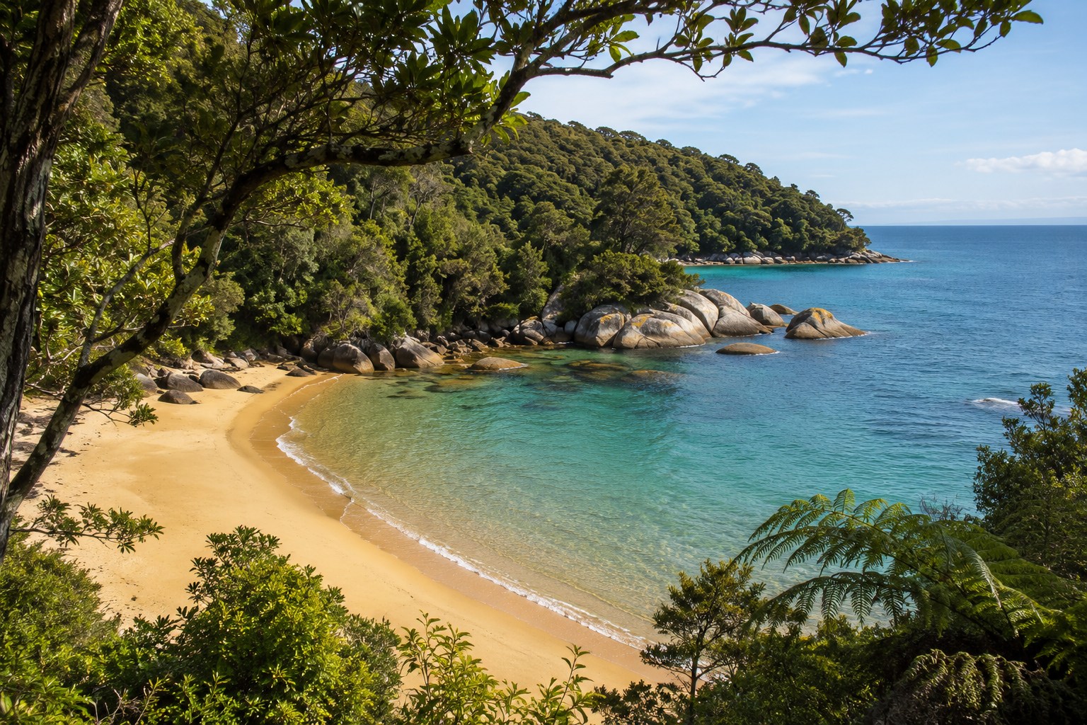
Abel Tasman National Park is known for golden beaches, sheltered bays, coastal forest and sea kayaking. The Abel Tasman Coast Track can be walked over several days or experienced in smaller sections using a water taxi from places such as Mārahau, Anchorage and Tōtaranui. Sea kayaking adds a water-level view of the headlands and coves, while the walking track gives access to forest, beaches and overnight huts or campsites.
The Awaroa Inlet crossing is a crucial planning detail. DOC permits crossing only within the designated low-tide window—one hour and thirty minutes before to two hours after low tide under suitable conditions—and there is no all-tide walking alternative around the inlet. Daylight, storm surge and rainfall still matter. The Abel Tasman Coast Track conditions and tide tables determine whether a particular itinerary works. A prearranged water taxi can help shorten a trip, but its departure point and schedule must match the walking leg.
Inland, Nelson Lakes National Park and Kahurangi National Park lead into more demanding tramping terrain. The Heaphy Track passes through varied ecosystems between Kahurangi's mountains, forest and coastal lowlands. Across the water in the Marlborough Sounds, the Queen Charlotte Track connects sheltered bays and ridgelines, with walking and cycling options on permitted sections.
Canterbury and the West Coast: glaciers, rock and alpine views
Aoraki/Mount Cook National Park sits beneath the country's highest mountain. The Hooker Valley Track is a particularly useful example of an alpine setting without a technical summit: DOC gives the full return walk to Hooker Lake as 10 km and about three hours, graded easy to intermediate. Swing bridges, glacier-fed water, moraine and views towards Aoraki make it memorable, but cold wind and changes to bridge or track access still call for a condition check. The area is a significant Ngāi Tahu landscape, with Aoraki recognised as a revered ancestor.
Arthur's Pass National Park provides forest-to-alpine walks along the Southern Alps/Kā Tiritiri o te Moana. On the West Coast, Westland Tai Poutini National Park includes the glacier valleys around Franz Josef/Kā Roimata o Hine Hukatere and Fox Glacier/Te Moeka o Tuawe. Glaciers and access routes change with ice movement, rockfall and river conditions; guided glacier experiences and valley viewpoints serve different abilities. Farther north, Paparoa National Park contains limestone landscapes around Punakaiki and the Pancake Rocks, while the Paparoa Track offers a longer tramping or mountain-biking challenge.
In the Mackenzie Basin, Lake Tekapo/Takapō and the Aoraki Mackenzie International Dark Sky Reserve open up a slower kind of outdoor recreation. Stargazing works best on clear nights away from bright lights; winter's longer nights can be excellent, provided cloud, ice and cold temperatures are factored into the outing. Clear skies are never guaranteed by the calendar.
Otago and Fiordland: biking, adventure sports and Great Walks
Queenstown and Wānaka place lakes, mountains and cycle trails close to adventure operators. Around Lake Wakatipu, the Queenstown Trail suits leisure cycling on selected sections, while the Shotover and Kawarau rivers anchor jet boating, rafting and bungy experiences. The Kawarau Bridge is strongly associated with commercial bungy jumping. Skydiving, paragliding, canyon swinging, ziplining and guided climbing expand the choices beyond the water. Around Wānaka, Mount Aspiring National Park has mountain landscapes and backcountry routes that need a different level of experience from a lakeside walk.
Central Otago's Otago Central Rail Trail and Lake Dunstan Trail highlight how cycling reveals places missed on a fast road trip: former rail corridors, historic towns, vineyards, river gorges and high-country scenery. Around Dunedin, the Otago Peninsula offers coastal walks and viewing opportunities for seabirds, including the northern royal albatross at Taiaroa Head, while nearby beaches and reserves provide quieter outings.
Fiordland National Park is a world of steep-sided fiords, rainforest and waterfalls. Piopiotahi/Milford Sound and Pātea/Doubtful Sound can be explored on boat trips; kayaking is a more weather-dependent alternative. Te Anau is a practical base for day walks and departures into Fiordland. The Milford Track is 53.5 km over four days, with a fixed one-way itinerary, huts and transport arrangements during the Great Walks season. The Kepler Track loops through beech forest and alpine tussock, while the Routeburn Track crosses high country between the Fiordland and Mount Aspiring areas. Heavy rain can swell rivers and alter plans even in summer.
Southern Fiordland's Hump Ridge Track offers a three-day mix of coastline, forest and subalpine terrain, with its accommodation managed separately from standard DOC Great Walk bookings. South of the mainland, Stewart Island/Rakiura has the Rakiura Track, bird-rich forest, coastal habitats and dark skies. Kiwi can be active at night; a dim red light helps reduce disturbance, and sightings remain a privilege rather than a promise.
Short walks, Great Walks or the backcountry?
New Zealand has 13 national parks, but a national-park visit does not require a multi-day tramp. DOC track categories distinguish wheelchair-accessible short walks, easy short walks, walking tracks, tramping tracks and routes. A formed path with bridges is a very different commitment from an unformed route with river crossings and navigation demands.
The 11 Great Walk experiences are Abel Tasman Coast Track, Heaphy Track, Hump Ridge Track, Kepler Track, Lake Waikaremoana Track, Milford Track, Paparoa Track, Rakiura Track, Routeburn Track, Tongariro Northern Circuit and Whanganui Journey. Their shared label does not mean identical terrain or physical demands: the Whanganui Journey is paddled, the Paparoa Track is shared with mountain bikers, and the Milford Track has a prescribed direction and four-day schedule.
| Time available | Reasonable focus | What to settle beforehand |
|---|---|---|
| One to three hours | A formed forest loop, lookout, geothermal path or coastal short walk | Accessible grade, parking, current track status |
| A full day | Hooker Valley, part of Abel Tasman, a Great Ride section or a guided wildlife trip | Return transport, weather window and pace |
| Two to four days | A selected Great Walk, multi-day cycle route or a river journey with suitable skills | Huts, campsites, equipment and exit arrangements |
| Weeks or longer | Sections of Te Araroa and extended backcountry travel | Resupply, navigation, changing terrain and sustained fitness |
Te Araroa runs approximately 3,000 km from Te Rerenga Wairua/Cape Reinga to Motupōhue/Bluff. Walking one local section provides a genuine taste of the trail without the logistics of a through-hike. A fully booked Great Walk is not the end of the options: shorter DOC tracks and less frequented conservation areas can offer comparable landscapes without the same accommodation pressure.
Outdoor sports: cycling, paddling, surfing and snow
Cycling and mountain biking
Ngā Haerenga Great Rides comprises 23 routes across New Zealand, mostly off road. Choices range from scenic sections of the Hauraki Rail Trail, the Great Taste Trail and the West Coast Wilderness Trail to the Timber Trail, the Lake Dunstan Trail, the Alps 2 Ocean Cycle Trail, the Queenstown Trail, the Rotorua Whakarewarewa Forest Loop and the more technical Old Ghost Road. Riding a one-day section is entirely different from completing a remote multi-day route.
Trail grade, climbing, surface, fitness and available daylight matter more than the Great Ride label. A graded trail that feels easy on a conventional bike still needs thought when ridden on an e-bike with limited battery range or by a child. Bike hire, a luggage transfer, shuttle transport or a one-way vehicle relocation can change which route is realistic.
Water recreation and adventure activities
Sea kayaking in Abel Tasman or the Marlborough Sounds rewards calm conditions and good route judgement. Stand-up paddleboarding and sailing appeal on suitable sheltered waters, while the Poor Knights' underwater habitats are better suited to properly equipped snorkelling or diving trips. For a different kind of water adventure, rafting on the Kaituna River near Rotorua or around Queenstown and Taupō puts the experience in the hands of guides who assess river flows, rapids and participant ability.
Surfing around Raglan, Piha and the Bay of Plenty has its own learning curve. Beaches exposed to large swell are not interchangeable with sheltered swimming beaches. Swimming between red-and-yellow flags when lifeguards are on duty is a sound baseline; a lifejacket, weather judgement and appropriate paddling skills matter on boats and kayaks. Waitomo's glowworm caves and guided black-water rafting offer a contrasting underground experience, where water temperature, confined spaces and operator requirements shape suitability.
For organised adrenaline sports—bungy jumping, canyoning, ziplining, skydiving, abseiling, climbing or paragliding—individual operators set age, weight, health and weather restrictions. A scenic flight or a jet-boat trip may provide mountain and river views for a traveller who does not want a strenuous climb, though it remains subject to operating conditions.
Winter sports, fishing and gentler recreation
The ski fields around Ruapehu, Queenstown, Wānaka and Canterbury support skiing and snowboarding in suitable winter conditions. Whakapapa and Tūroa on Ruapehu, Coronet Peak and The Remarkables near Queenstown, Cardrona and Treble Cone near Wānaka, and Mt Hutt in Canterbury serve different groups of skiers. Road access, lift operations, snow cover and avalanche information need current verification; winter outside a ski area is not the same as a maintained ski slope.
Trout fishing in rivers and lakes adds a quieter sporting option around the Central North Island, Taupō, Canterbury and Otago. Freshwater sports fishing normally requires a licence from Fish & Game New Zealand, while the Taupō fishery has a separate DOC licensing system. Recreational sea fishing generally needs no individual fishing licence, but bag limits, species limits, size rules and closed areas apply. Special intertidal harvest restrictions apply along parts of the Auckland–Coromandel coast, making local rule checks essential. Golf, horse trekking and trail running offer further ways to use New Zealand's open landscapes without committing to an alpine expedition.
Wildlife watching without disturbing wildlife
Wildlife encounters are strongest when an animal's habitat dictates the itinerary. The Kaikōura coast draws sperm whales, dolphins, fur seals and seabirds because of the deep, food-rich offshore environment. Boat-based whale watching and dolphin encounters rely on sea conditions and respectful distances. No wildlife sighting is assured, even where the animals are regularly present.
For birds, Tiritiri Matangi, Zealandia, Kāpiti Island and Rakiura offer very different settings. Native species such as tūī, kererū, pīwakawaka, kākā and kiwi are part of these environments; the alpine kea is more likely to be encountered in South Island mountain country. Yellow-eyed penguins/hoiho, kororā/little penguins and fur seals need space on the coast. The Otago Peninsula and Southland's shorelines are not open invitations to approach nests, resting seals or breeding sites.
Glowworms in Waitomo are another form of wildlife tourism, experienced in caves where lighting and movement are tightly managed. For an ethical encounter, keeping a distance, leaving flash photography off where prohibited and following local conservation rules have more value than attempting a closer photograph. A DOC marine reserve is a protected habitat, not a place to collect shells, fish or other marine life.
When is the best season for nature and recreation?
| Season | Strong possibilities | Planning reality |
|---|---|---|
| Spring (September–November) | Forest walks, cycling, gardens and wildlife observation | Unsettled weather, cold alpine conditions and spring river flows |
| Summer (December–February) | Coastal walking, kayaking, swimming and Great Walk trips | Busy campsites, sun exposure, water hazards and bookings |
| Autumn (March–May) | Central Otago cycling, lower-altitude tramping and stargazing | Shortening daylight and colder mountain nights |
| Winter (June–August) | Skiing, snowboarding, thermal pools and night-sky viewing | Snow, ice, alpine closures and hazardous mountain travel |
Season is a starting point, not a safety forecast. Fiordland can experience heavy rainfall in summer. High mountain trails may hold snow outside winter. Coastal conditions can shift during a single day, and the clear sky needed for stargazing can disappear behind cloud. MetService forecasts, DOC alerts, tide information and operator updates are more useful for the final decision than an average monthly temperature.
How to plan a realistic outdoor trip
Start with the most restrictive condition. If a group includes young children, look for a short walk, an appropriate track surface and convenient toilets before choosing a famous landscape. For an experienced group planning a hut trip, identify the hardest section, the transport at both ends and the consequence of poor weather. For a wildlife outing, find the time and type of viewing that minimise disturbance rather than building the day around a guaranteed photograph.
- Time and effort: distinguish a 90-minute return walk from a full-day crossing and a multi-day tramp. Allow for stops, slower walkers and changing conditions.
- Access: some routes start and finish in different places. Ferries, water taxis, shuttles and rural road conditions may control the schedule.
- Ability: track categories, gradient and surface describe more than distance alone. DOC identifies wheelchair-accessible short walks; Bennetts Bluff Viewpoint near Glenorchy is one specific option, an 800 m return route taking approximately 15 minutes.
- Accommodation and cost: national parks offer extensive public access, while huts, campsites, transport, guides and equipment hire carry separate costs. Popular Great Walk facilities often require advance bookings; the Hump Ridge Track has its own booking arrangements.
- Permissions: national parks, marine reserves, private farmland and local council land have different access rules. Dogs, drones, fires, camping and fishing can be restricted.
- Backup: a sheltered forest walk, cultural geothermal visit or shorter cycle section can replace a high-risk alpine or marine outing when conditions deteriorate.
Auckland-based travellers can combine an island sanctuary with an easy volcanic walk. Rotorua offers a compact pairing of geothermal trails and bike riding. In Canterbury, a day in the Hooker Valley and a night around Takapō combine alpine views and stargazing without an overnight tramp. A Queenstown base can balance lakefront recreation, a graded Great Ride section and a guided adventure. A Te Anau stay opens access to Fiordland's short walks and boat excursions, while a full Milford Track journey needs a separate four-day commitment.
Safety, access and caring for Aotearoa
The New Zealand Land Safety Code rests on five practical actions: choose a suitable trip, understand the weather, take warm clothing and extra food, share plans and carry ways to get help, and care for everyone in the group. The Mountain Safety Council's Plan My Walk helps with route planning; DOC provides current track classifications and alerts. A registered personal locator beacon is valuable in remote country where mobile coverage is unreliable. Emergency services in New Zealand can be reached on 111.
In alpine country, review snow and avalanche conditions and be prepared to turn back. On rivers, high water can make a familiar crossing impassable. On the coast, tidal inlets, rips, swell and wind deserve their own checks. The Tongariro volcanic area also requires attention to current DOC volcanic-risk information. An official route being open does not override conditions that exceed a particular group's skills.
Care for the landscape is part of recreation rather than an optional extra. The Tiaki Promise encourages care for land, sea, people and culture. Keep to formed tracks, remove rubbish, use toilets, leave native plants and animals undisturbed and follow local fire restrictions. Clean and dry footwear, bikes and water equipment between places to reduce the spread of kauri dieback, didymo and other pests. Respect mana whenua, wāhi tapu and private property; a visible path across a farm does not automatically provide public access.
Camping is permitted only where the relevant rules allow it. DOC restrictions on freedom camping are separate from council bylaws; a car park beside a scenic attraction is not automatically a freedom-camping site. The same applies at sea: fishing rules differ by area and marine-reserve protections apply even when the water looks inviting.
Common questions about outdoor recreation in New Zealand
Can beginners enjoy New Zealand's national parks?
Yes. Easy short walks, formed viewpoints and guided experiences provide access to natural landscapes without advanced navigation or alpine skills. A national park may contain easy tracks and expert routes side by side, so the specific track category matters.
Are all Great Walks suitable for walkers?
No. The Whanganui Journey is a multi-day river-paddling experience, and the Paparoa Track also permits mountain biking. Other Great Walks vary in distance, exposure, transport requirements and seasonal access.
Is a summer hike always safe from snow?
No. Alpine weather changes quickly and snow can remain or fall at elevation outside the winter months. The Tongariro Alpine Crossing and exposed Southern Alps routes need current weather and track-condition checks for the chosen date.
Is wildlife easier to see on a tour or independently?
Guided marine trips and conservation visits can help with access and local knowledge, while independent birdwatching works well on many public walking tracks. Neither option guarantees an encounter. Ethical distance, breeding restrictions and the animal's behaviour take priority.
Can a nature holiday work without a car?
City reserves around Auckland and Wellington are comparatively accessible by public transport. Remote trailheads, island sanctuaries and one-way tramps often require ferries, shuttles or organised transfers. Transport availability needs to be established before fixing the itinerary.
New Zealand's richest outdoor experiences are not defined by distance or difficulty. A quiet hour among native birds, a ride along an old rail corridor, a paddle through a sheltered bay and a demanding alpine traverse each offer a different connection to place. The right terrain, a realistic plan and respect for local conditions make that connection possible.